In July 2017, a giant iceberg, named A-68, snapped off Antarctica’s Larsen-C ice shelf and began an epic journey across the Southern Ocean.Three and a half years later, the main part of iceberg, A-68A, drifted worryingly close to South Georgia. Concerns were that the berg would run aground in the shallow waters offshore. This would not only cause damage to the seafloor ecosystem but also make it difficult for island wildlife, such as penguins, to make their way to the sea to feed.
Using measurements from satellites, scientists have charted how A-68A shrunk towards the end of its voyage, which fortunately prevented it from getting stuck. However, the downside is that it released a colossal 152 billion tonnes of freshwater close to the island, potentially having a profound effect on the island’s marine life.
When A-68 was spawned, it had a surface area of more than twice the size of Luxemburg – one of the largest icebergs on record.
It lost a chunk of ice almost immediately after being calved, resulting in the larger berg being renamed A-68A, and its offspring became A-68B. In April 2020, A-68A lost another chunk subsequently called A-68C.
Antarctic icebergs are named from the Antarctic quadrant in which they were originally sighted, then a sequential number, and then if the iceberg breaks, a sequential letter is added.
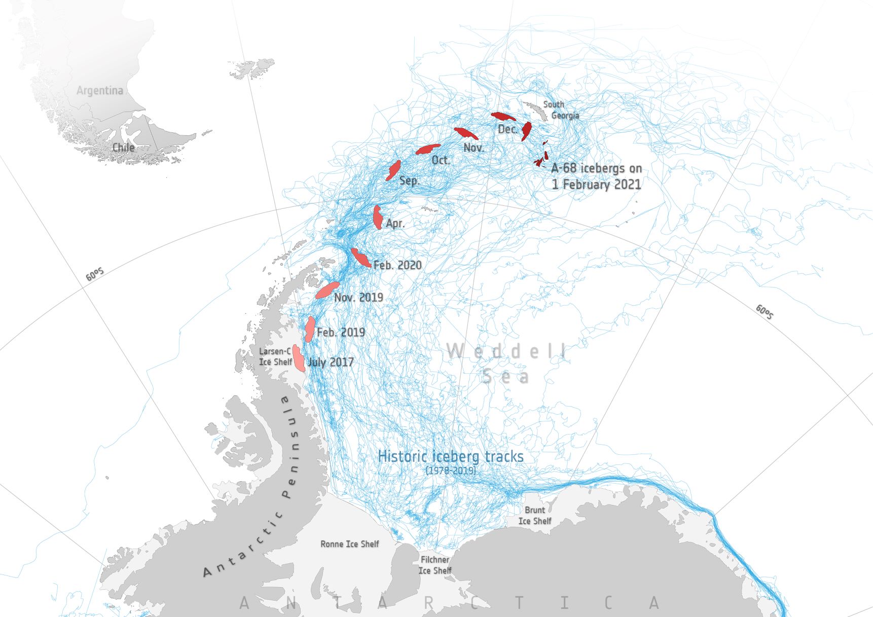
For the first two years of its life, A-68A stayed in the cold waters of the Weddell Sea close to its parent ice shelf. Here, it experienced little in the way of melting. However, once the berg began its northward journey across the Drake Passage, it travelled through increasingly warm waters and began to melt.
Altogether, the A-68A iceberg thinned by 67 metres from its initial thickness of 235 metres, with the rate of melting rising sharply as the berg drifted in the Scotia Sea around South Georgia.
A paper published in Remote Sensing of Environment describes how researchers from the Centre for Polar Observation and Modelling in the UK and the British Antarctic Survey combined measurements from different satellites to chart how A-68A changed in area and thickness throughout its life cycle.